However, one of the things I would recommend is hiking up the Jochart. I know … getting out of the car and using your feet when on a road trip … unheard of, but it is going to be worth it. Not only does it lead you to the beginning of the best way back to Vienna, it also offers you a fantastic view.
If you’re coming from the West, take the left at the intersection right before the town sign of Rohr am Gebirge. This leads you onto a road about one and a half cars wide. After about one kilometre you’ll see a small house on the left side. This is important to remember because it is going to be start of your hike!
Unfortunately, there are no car parks right there. Either you park in Rohr, or you drive one or two curves further, only adding about 100 meters, and park your car on the gravel on the right. When you’re there you’ll know what I mean.
However, when you park there please keep in mind that this place is used by foresters to stack wood. While it is not illegal to park here, be considerate enough to not block any access to the stacked wood should they want to pick up when you happen to be there.
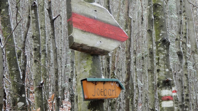
Then you can set off to hike up the Jochart. The route is marked as red, and there are signs leading you to the very top. Hence, it is quite hard to get lost unless you happen to be blind. The route is split into two stints. One takes you to the Hammerleck – which is around 900 meters. The very first part of the climb is pretty easy. It really made me wonder who thought that this should be classified as a red route …
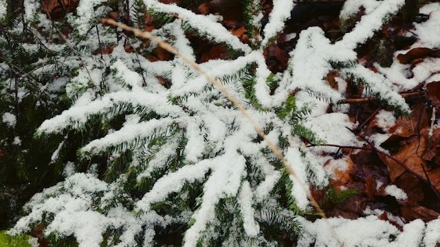
Furthermore, on the day I was hiking 900 meters marked the snow line. I never knowingly crossed into it. You'll notice that there are slight drops falling but they’re above you. Then as you cross into you, you begin to notice that the snow sticks to the trees and leaves.
The last meters to the Hammerleck make you realize why this was classified as a red route. Especially hiking up in late autumn with wet leaves under my feet there was one or two occasions that made me wish I hadn’t forgotten my jogging shoes at home … In fact, I adopted a small stick for assistance.
Once you made it past this bit, you’re past the worst. Afterwards, a smaller and slightly twiddly trail leads you along to the last 300 meters. Before you know it, you are at the top, and not a bit lower than 1,200 meters above sea-level.
Then you are gifted with two different views. Towards the West you can see into the alps. The beginnings of what leads to the highest mountains of the continent, while to the East you almost begin to realize why Lower Austria is called that as the mountains fall away.
I was gifted with an amazing view. I was about to write “and with the first snow of the year” but that happened in August at the Glockner. Instead I am going to opt for, it gave me the first snow of this season!
Furthermore, there was a sense of gratification because I had just managed something that wasn’t all too easy and was gifted with a pretty decent view as well. Win – win.
Then again, I am somewhat of an athlete and my brother would have been pretty willing to stab me for dragging him up there – if he had come along. If you’re a little bit fit, you should do fine hiking upwards … otherwise, some cursing might be involved.
After making my way back down again – which included the most graceful fall onto my arse – I set off back home. I suggest you do not turn around when you set off again, instead follow the road you were in and you’ll be gifted with an amazing back road.
More of that soon 😉
Read More About The Kalte Kuchl Trip:
| ⌫ Previous | Next ⌦ | |
|---|---|---|
| The Beauty of The Kalte Kuchl | | | The Back Roads of The Kalte Kuchl |


Post a Comment